


Voting District 16-B, Buchanan County, Missouri
About
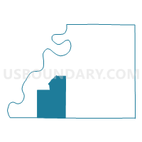
Outline

Summary
| Unique Area Identifier | 607237 |
| Name | Voting District 16-B |
| County | Buchanan County |
| State | Missouri |
| Area (square miles) | 44.94 |
| Land Area (square miles) | 44.88 |
| Water Area (square miles) | 0.07 |
| % of Land Area | 99.85 |
| % of Water Area | 0.15 |
| Latitude of the Internal Point | 39.58899230 |
| Longtitude of the Internal Point | -94.93439280 |
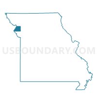
Maps

Graphs
Select a template below for downloading or customizing gragh for Voting District 16-B, Buchanan County, Missouri


Neighbors
Neighoring Voting District (by Name) Neighboring Voting District on the Map
- Voting District 10-A, Buchanan County, MO
- Voting District 16-C, Buchanan County, MO
- Voting District 16-D, Buchanan County, MO
- Voting District 16-G, Buchanan County, MO
- Voting District 9-C, Buchanan County, MO
- Dye 21 Voting District, Platte County, MO
- Lakeview 20 Voting District, Platte County, MO
- Pisgah 22 Voting District, Platte County, MO
Top 10 Neighboring County Subdivision (by Population) Neighboring County Subdivision on the Map
- Center township, Buchanan County, MO (3,049)
- Crawford township, Buchanan County, MO (914)
- Rush township, Buchanan County, MO (892)
- Marshall township, Platte County, MO (716)
- Wayne township, Buchanan County, MO (683)
- Bloomington township, Buchanan County, MO (674)
- Lake township, Buchanan County, MO (35)
Top 10 Neighboring Place (by Population) Neighboring Place on the Map
Top 10 Neighboring Unified School District (by Population) Neighboring Unified School District on the Map
- St. Joseph School District, MO (80,701)
- Mid-Buchanan County R-V School District, MO (4,290)
- West Platte County R-II School District, MO (3,822)
- Buchanan County R-IV School District, MO (2,123)
Top 10 Neighboring State Legislative District Lower Chamber (by Population) Neighboring State Legislative District Lower Chamber on the Map
Top 10 Neighboring State Legislative District Upper Chamber (by Population) Neighboring State Legislative District Upper Chamber on the Map
Top 10 Neighboring 111th Congressional District (by Population) Neighboring 111th Congressional District on the Map
Top 10 Neighboring Census Tract (by Population) Neighboring Census Tract on the Map
- Census Tract 28, Buchanan County, MO (4,854)
- Census Tract 307, Platte County, MO (3,382)
- Census Tract 29, Buchanan County, MO (3,250)